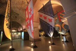
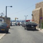
Take a fascinating tour along Akko’s Walls.
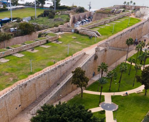
The route of the Old Akko walls begins in the northern moat and includes observation points along the walls that surround the city from all sides. The tour reveals the city walls that have been preserved almost intact and the wars that dictated the character of the city.
1
The route of the Old Akko walls begins in the northern moat and includes observation points along the walls that surround the city from all sides. The tour reveals the city walls that have been preserved almost intact and the wars that dictated the character of the city
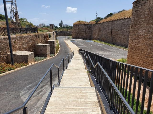
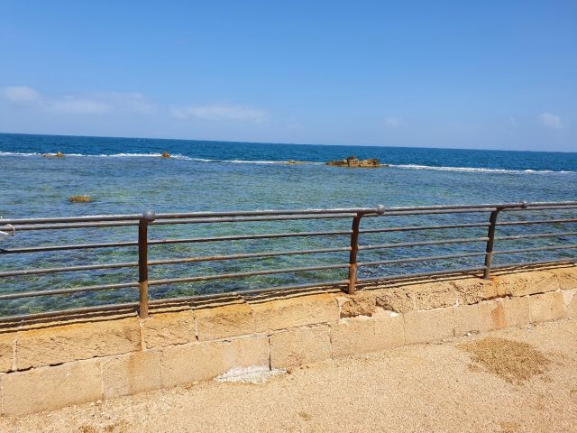
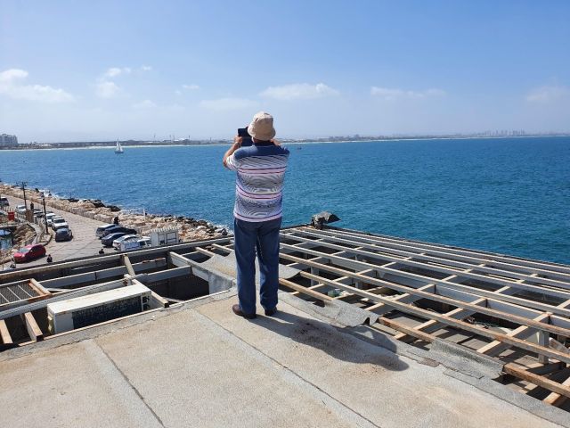
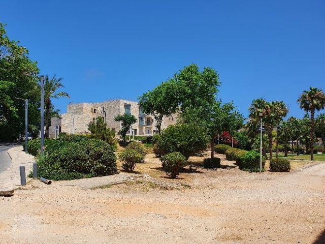
Wall at the Northern Moat Exit
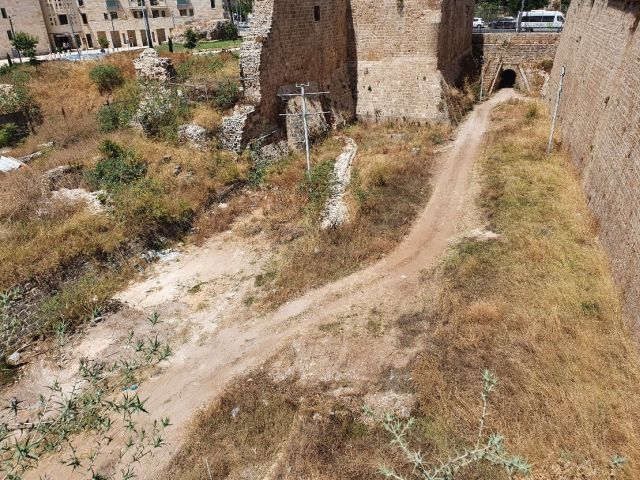
2 Northern wall
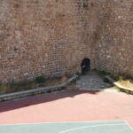
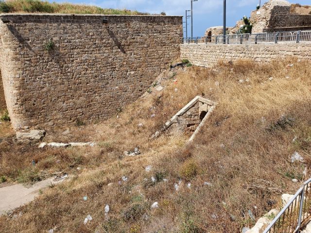
Western Poterna
This is the northern wall line of Old Akko which was built in the 19th century after the Napoleon siege. In this wall as in the wall that preceded it built by Daher al-Omar (1745-1775), secret tunnels (Postern) were incorporated. They crossed the wall from the inside of the city to the outer moat and were used by the besieged city to introduce supplies and reinforcements under cover of darkness. These secret tunnels were not observed from the enemy lines besieging the city because they were located at the bottom of the moat. As a result, they were also used in a guerrilla war in which soldiers from the besieged city raided the enemy’s siege lines at night and killed his soldiers, thus harming the morale of the besieging soldiers on the city. Evidence of these attacks is described in history books describing Napoleon’s siege of the city in 1799.
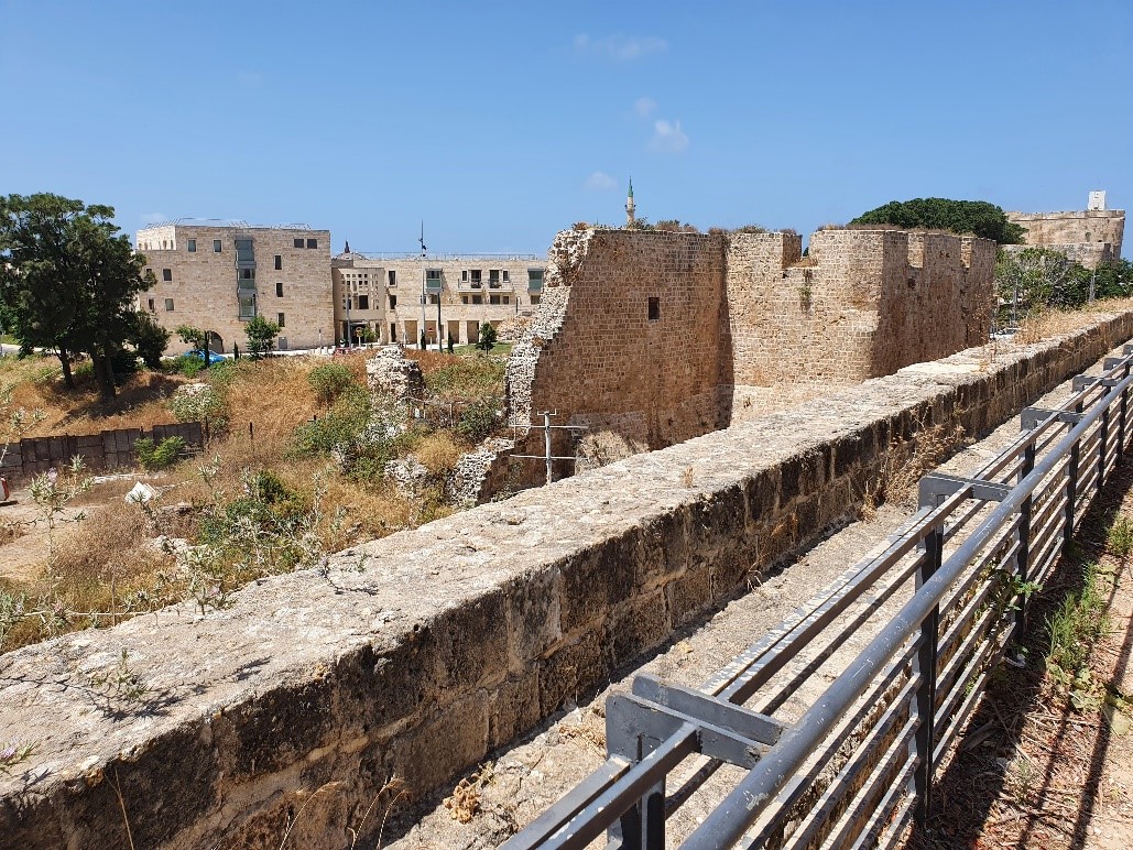
3 Akko Fortifications
Array of Ottoman Akko fortifications, moats and barbicans
After the siege of Napoleon in 1799, the walls of Old Akko were severely damaged. Al-Jazzar, the legendary ruler who prevented Napoleon from conquering the city, realized that there was no point in rehabilitating the damaged city walls, as they were unsuitable for protection against heavy field cannons that went into action during the siege.
With the help of French engineers, Al-Jazzar planned a new fortification system for the city. The walls began to be built immediately after Napoleon’s siege in the days of Al-Jazzar but he died in 1804 before completing the work, which was completed by his successors Sulayman and Abdullah. The inner wall is built of parallel stone walls built of large ashlars. Most of the stones are in secondary use from the Crusader period, including stones taken from the dismantling of the Crusader fortress in Atlit. Between the parallel walls, which sometimes reach a width of many meters, there is a soil fill. A deep moat was dug beyond the inner wall, beyond which a wide wall was built, also built of large ashlars. Beyond the outer wall line, high earth embankments were poured, which protected the walls of the outer wall from being hit by heavy cannons. Powerful watchtowers were built at the corners of the inner wall, Burj Al Komander at the northeast corner and Burj El Karim at the northwest corner. Additional towers were incorporated between them, along the walls and in the towers were placed cannon positions that fought back against the enemy attacks.
Haganah Street – British Bridge over the moat
During the British Mandate, Akko was a sub-city in the Galilee where a British police building was built (the Tegart building) that characterizes the buildings of the British police in the country, and is currently used by the Israel Police. In the Old City, the Ottoman rulers’ palace became a central British prison in the north. To facilitate control of the Old City and with the entry of the motor vehicle into use, the British broke two gaps in the city walls and paved roads that allowed motorized vehicles to enter the Old City. The breaches have been pierced in the northern wall of the city. One breach can be seen in the west of the city, present-day Haganah Street, which allowed access to the prison. The second breach was made in the eastern part of the city today, Weizmann Street, a road that led to the port. For this purpose, they built bridges over the city moat at the breaches points, to allow the road to be paved over the moat.
British Bridge over the Moat
4 Burj al-Karim
Here we see a defense tower in the northwestern corner of the walls of Old Akko from the Ottoman period. This tower was built outside the city walls in an octagonal shape so that on our left there is a view to the south in direction of the western sea wall, and to the east a view of the northern mainland wall. Accordingly, surfaces were prepared in the tower for cannon positions that were placed on the site and could protect attempts to break through the wall from the west or north from the mainland.
This tower is a tower built with the construction of the new walls after the siege of Napoleon in 1799. The new walls were built by Al-Jazzar and his successors in the early 19th century. Burj al-Karim is located on the foundations of a round tower built on the site during the Crusader period in the 12th century. The Crusader tower marked the northwestern end of the city walls. Since during the Crusader period the Muslim navy did not have warships in the Mediterranean that could endanger Akko from the sea, no sea wall was built in the western part of the city.
5 Burj al-Karim
Artillery positions
In Burj al-Karim, in the surrounding tower, many surfaces are visible for placing cannons for the defense of the city. With the advancement of ground attack cannons, the city walls in the 18th and 19th centuries could not withstand the direct attack of heavy cannons. Therefore, the walls of Akko designed by French engineers, who knew the power of the cannons at that time and designed the walls of Al-Jazzar after the siege of Napoleon, designed a particularly thick wall. A wall at which top and in which towers cannons can be placed that will return fire and keep the enemy cannons away from its border. Thus, the city walls at that time became from defensive walls to walls with offensive capability.
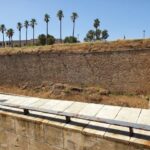
6 Western Wall
Ammunition depot
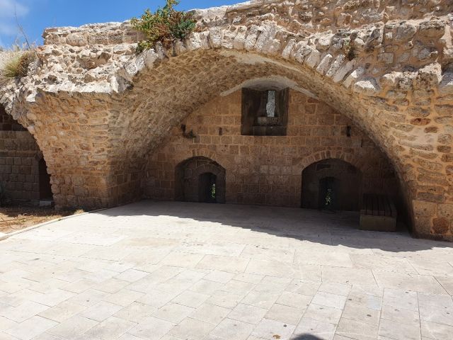
Remains of a massive vaulted structure may be the remains of a Crusader structure. In the Ottoman period can be seen in its northern front the remains of a massive wall that leans against it. These are the remains of the fortifications of the Ottoman garrison that resided in the city.
During this period there was a physical separation between the city walls, its towers and warehouses, and the local population living in the city. The citizens of the city were forbidden to reach the line of walls and in this area a section of this dividing line is preserved. The building itself was probably used as a fortified ammunition depot in the city’s western defense system.
Western Wall- Ammunition Depot
7 Tower in the western wall
The tower is integrated into the western wall array. It extends westward toward the sea from the wall line itself. Thus, cannons placed there could keep away any enemy trying to approach and hit the wall from the north or south and even keep away any enemy vessel trying to reach the walls from the sea.
Western Wall Tower, Offensive/ Defensive System
8 Western wall
Observation point
Old Akko is built on a natural kurkar bedrock foundation that encloses the Akko Bay to the west and forms a peninsula. To its east was the port of Akko. The city was founded on this ledge next to the harbor. The settlement began at this location in the days of Ptolemy II, an Egyptian king who conquered Akko in the second half of the third century BC. Akko served as a major port city in ancient times, a city of commerce, a major sea gate to the Land of Israel.
Western Wall- Observation Point
9 Western Wall
Ottoman barracks (military outpost)
Remains of the wall from the Ottoman period of Akko, built during the days of Daher al-Omar in the second half of the 18th century and strengthened later after the siege of Napoleon in the early 19th century. Here is a section of the walls in which warehouses of the Ottoman garrison were deployed to defend the walls. The walls also incorporated many cannon positions that protected the city. The walls in this section of the city were built mainly of Crusader stones from the 13th century ‘Lion Fortress’ of the Templar Order built in the area of the lagoon to the south. The Crusader construction is evident in the use of well-dressed large ashlars and they are seen in secondary use in the city walls in this section. The section of paved street on Haganah Street parallel to the wall was paved during the British Mandate. In the Ottoman period it was a military area that separated the buildings of the civilian city from the military wall compound and the citizens of the city were not allowed to approach it. The warehouses have been rehabilitated and preserved in recent years, as have sections of the city wall.
Western Wall- Observation Point
10 The Lagoon
Templar Fortress
The description of the quarter by the secretary of the head of the Order reads: “It was the most fortified place in the city and occupied a large area on the beach. At its entrances stood a tall and very strong tower, and its walls were very strong (28 feet thick), on each side of the citadel was a small tower, and on each tower stood a statue of a mighty lion. The whole is gold plated”. The remains of this Templar fortress were preserved until the 18th century, when Daher al-Omar, ruler of Akko in 1750-1775, destroyed the fortress and used its stones to build the sea walls of Old Akko. North of the fortress, at the northern end of the lagoon, was built around tower, the treasury tower of the Templar Order. The members of the Order who were brave knights, who protected the pilgrims and their property on their way to Jerusalem, were also considered the first bankers in history. They were privileged to amass a particularly high fortune kept in this place. The Templar Fortress was the last stronghold to fall to the Mamluks in 1291. The fall of the fortress symbolizes the end of the Crusader kingdom in the Holy Land.
The Lagoon- Templar Fortress
11 The Lighthouse
The Akko Lighthouse stands on a tower, Burj El-Sanjak, in the southwest corner of the Old City, and serves as a navigation and warning sign for ships approaching the city in the dark from the west. This lighthouse was probably built in 1912 by French engineers, after the previous lighthouse built in 1864 was damaged by sea storms and stood on the edge of the lagoon to the north. The current lighthouse is operated under the responsibility of the Ministry of Transport.
12 St. John's Church
Southern Wall
A Latin Catholic church stands near the southern wall of Old Akko. It was built in the first half of the 18th century. The church is built on the wall level above a spacious basement floor. Limited archeological excavations in the basement revealed remains of a public building from the Crusader period.
St. John’s Church
13 A cemetery during Napoleon’s Siege
In the area around the visible domes there is a local cemetery within the city limits. Most of the cemetery was demolished and various structures were built above it but a number of tombs can still be seen in the area. In this cemetery, the dead were traditionally buried in the city during the siege of Napoleon when it was not possible to go outside the walls to the city cemeteries.
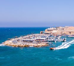
14 Lookout from the southern wall over Doniana Restaurant
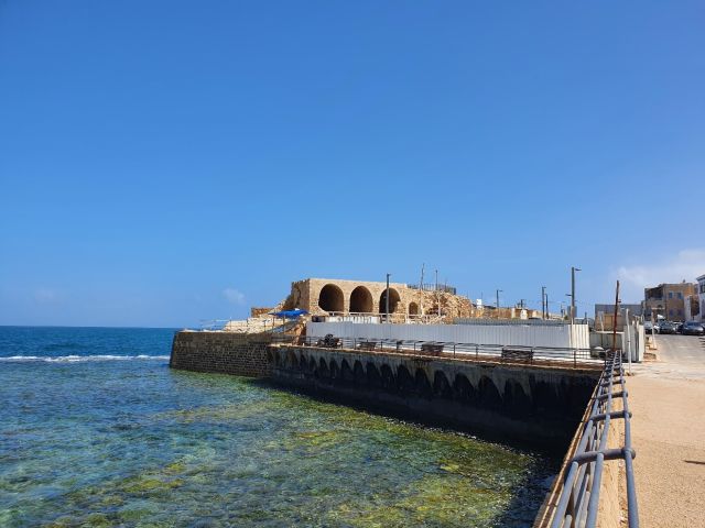
The port of Akko was built at the northern end of Akko Bay. It was built in the second half of the third century BCE by Ptolemy II. During this period the city became the most important port city on the shores of Palestine. To create of a relatively protected port in this part of the Akko Bay, a breakwater was built and covered in modern times with new boulders along the breakwater from the Hellenistic period. New underwater excavations carried out by the Marine Unit of the Israel Antiquities Authority along the eastern wall revealed the remains of a pier and marine shipyard, dating to the Hellenistic period. It turned out that along the entire eastern wall about 2 meters below sea level, there was a natural kurkar bedrock surface on which the wall was built. Above the natural rock a marine fill was discovered that was performed in layers naturally above the rock. At a height of about 60 cm above it were placed large ashlars (40 cm high, 20 cm wide and 80 cm long). They were laid using the head and stringer method and formed a built-in pier. So far, various sections of its tens of meters long have been exposed. Part of the pier exists below the Ottoman wall and the other part extends east of the wall in a southeasterly direction, and it has not yet been exposed its entire length. Thanks to the pier building, Akko has become a bustling port city with a protected port and has been used throughout history as an important station in the eastern and western connections in the Mediterranean.
15 The Pisan Quarter
Remains of a Roman Hellenistic Breakwater and above it remains of the Ottoman Sea Wall
With the founding of the new city of ‘Ptolemy’ by Ptolemy II in the second half of the third century BCE, the process of abandoning ‘Tel Akko’ and moving the city to the plains west of the tell was completed. During this period (the Hellenistic period), a breakwater was built that turned the northern end of the bay, east of the peninsula, into a protected port. Akko has become an international port and trading city in the eastern basin of the Mediterranean Sea. The breakwater that began here, and its remains are still visible as a row of rocks in front of the Doniana restaurant, continues east along the current pier and was covered in modern times (British Mandate and State of Israel) with a modern pier. At the eastern end of the Hellenistic pier a tower was built which marked the western entrance to the port. East of it was built the ‘Tower of the Flies’ which marked the eastern entrance to the harbor. This port has been used by Akko throughout history to the present day, the remains of the arched buildings that are seen in front of the restaurant and at sea are the remains of warehouse buildings that were at the rear of the port in the Ottoman period. During the Crusader period this area was within the boundaries of the Pisan Quarter.
Remains of the Roman Hellenistic Breakwater
16 The gate to the eastern wall compound for the garrison only
During the Ottoman rule there was a separation between the urban civilian area of the city and the area of the walls and port which was an Ottoman military territory. Citizens were not allowed to approach this area. For this purpose were built control gates, through which only the Ottoman garrison was given access to the walls. Here was placed one of the gates which prevented access to the port. Remains of the wall in which the gate was incorporated can be seen next to the walls of the El Marsa restaurant. The wall was destroyed during the British Mandate as they broke through the walls of the Old City and paved an access road to the Old City and the harbor.
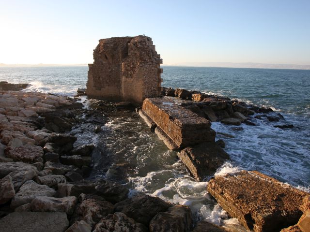
17 Burj Al-Sultan, the Akko port guard tower from the Crusader and Ottoman periods
Burj Al-Sultan stands on the water line north of the port of Akko and dominates the entrance route to the port. It was built during the Crusader period and on its southern and eastern façade you can see arrow slits. Hence the purpose of its construction was to protect the port entrances. It is one of the few towers that have survived to the present day from the Crusader period. One reason for this is its strategic importance for port control. The Mamluks who conquered Akko from the Crusaders in 1291 destroyed the city walls, destroyed its buildings, killed or expelled its inhabitants. Since Akko symbolized the Crusaders’ rule on the Holy Land coastal plain, they made sure that it remained desolate. But the Mamluks kept a small garrison that would control what was happening in the port, this garrison sat in Burj Al Sultan. At the top of the gate on the western front of the Burj there is a Mamluk inscription attesting to this. During the Ottoman period, probably after the partial collapse of the tower in its part facing the sea, perhaps as a result of the Napoleonic siege, the tower was repaired and cannon positions were incorporated into it.
18 Daher al-Omar Gate
Daher al-Omar (1745-1775), the ruler of the Galilee, built Akko from its ruins after the Crusaders’ defeat in 1291.
Daher, a member of a Bedouin family who established a settlement in Tiberias in the 18th century, makes Akko the capital of his kingdom in northern Israel in 1745. In that year he removes the Ottoman unit from Akko and takes over. From 1750 he fortifies the city with new perimeter walls and builds his palace.
With great cunning, Daher takes over the trade in Galilee goods by buying the farmers’ crops, such as cotton, wheat, olive oil and more: highly sought-after goods that he sells to European merchants at high prices.
With the help of this wealth he builds his capital Akko and recruits a large army of mercenaries who defend his kingdom. He rules the kingdom with order and security which enable agricultural and trade development.
The remains of Daher wall are visible in various places in the northern part of Old Akko, in the inner line of walls in the city’s array of walls. These walls stood in front of Napoleon and his cannons during the siege of 1799.
In this place stands the land gate of Old Akko which in the days of Daher al-Omar was called the Lion Gate. At its head was set an inscription made of a plaque in which Daher greeted the visitors at the city gates. This inscription has been preserved and is displayed in the Knights Halls.
19 Kapo Burj
Land Gate
Kapo Burj is the mainland gate and the main entrance to Old Akko.
Another gate to the city is the Sea Gate through which entered the seafarers who arrived with their ships at the port of Akko. This gate was built by Al-Jazzar in the early 19th century and replaces the land gate of Daher al-Omar walls built in 1750 and was about 50 meters west of this gate.
The gate is protected by a heavy door coated with metal plates as protection against attempt to set the gate on fire. It is also protected on all sides by the Kapo Burj watchtower, topped by many firing slits that thwart any attempt to reach the gate and break into the city. The gate stands at 90 degrees to the road leading to it and thus slows down those trying to break through the gate to the city and reduces the amount of warriors who can reach the gate at the same time. At this gate entered all the merchants and farmers who came to trade in the markets of the Old City, closed and covered markets such as the White Market and the Turkish Bazaar. Expensive as well as small goods were traded in the markets and in the bazaar shops or in open markets such as Khan A-Shawarda, where cattle and agricultural crops came from the villages of the Galilee.
20 Gate to Al-Basha Gardens and the Eastern Wall
In this place, there is a thick wall between the western wall of the ‘Akkotel’ boutique hotel and the building opposite.
This wall served as a boundary in which a gate was placed that allowed access to Al-Basha Gardens and the eastern city walls only to members of the Ottoman government and prevented the entry of the city civilian residents.
21 Al-Basha Gardens
During the Crusader period in the 12th century, the Crusader King’s Gardens were located in the area of the Youth Hostel and the eastern zone where an open garden is now. Slightly west of the Youth Hostel, was the King’s Palace. In the 13th century the Crusaders returned to Akko on the 3rd Crusade (1191), a journey led by Richard the Lionheart King of England. Richard regained control on the coastal plain from Beirut to Apollonia but failed to regain control of Jerusalem. In doing so, he renewed the Crusader kingdom of Jerusalem without its capital, Jerusalem. Akko became the capital of the kingdom for the next hundred years. Its population grew and crowded within the walls. Therefore, instead of the King’s Gardens, a new residential district was built, the remains of which can be seen in the courtyard of the Youth Hostel. During the Ottoman period in this area, gardens were again developed, this time called Al-Basha Gardens, for the use of the administration officials.
Al-Basha Gardens
22 The Eastern Wall
The Al-Jazzar wall was built in the first half of the 19th century by Al-Jazzar and his successors and after the city walls were destroyed by the Napoleon siege in 1799. These walls were designed to protect the city against the heavy artillery shelling that came into use in those years. Therefore, the wall is very wide and many cannons are placed on it, designed to fight back and keep the armies away from trying to approach the city and bring down its walls. The city walls are also surrounded by a deep moat and a strong outer wall, to which were added external earthworks that prevented damage and destruction of the walls by direct cannons hit. At the current location of the moat garden, west of the walls, stood the ‘Donkey Khan’, the ammunition depot of the Egyptian Muhammad Ali, ruler of Akko in 1840. Muhammad rebelled against Ottoman rule and took control of Akko and the Galilee. A joint fleet of English and Turkish ships attacked Akko this year. The shelling damaged the ammunition depot that caused much destruction and many casualties in the city and led to the surrender of Muhammad Ali and his withdrawal from the Land of Israel.
23 The aqueduct to Akko
The aqueduct to Akko originates from the Kabri springs (18 km northeast of Akko). The aqueduct was originally built by Al-Jazzar but was destroyed in 1799 during Napoleon’s siege of Akko.
The aqueduct was rebuilt by Suleiman Pasha in 1815. It was the main water source for Old Akko until the early 1950s, when Akko was connected to Mekorot’s national water system. The Suleiman aqueduct replaced the original water aqueduct of Akko that led the waters of the Kabri springs to Old Akko. In this section the aqueduct is made of stone rings in the center of which is a round cavity for the passage of water. This system operates as a closed system (Communicating vessels Principle). At this point, the aqueduct entered the Old City and fed dozens of ‘Sabil’ (public water fountain), and a number of emergency water reservoirs, including the Ottoman rulers ‘Palace (today the Underground Prisoners’ Museum) and a reservoir under the Al-Jazzar Mosque. The aqueduct also fed a number of hammams around the city.
Aqueduct to Akko
24 Al-Jazzar Wall in front of the Daher Wall
The Old City was founded in the Hellenistic period in the second half of the third century BC by the second Ptolemy ruler who then ruled the Land of Israel. The city limits in the Hellenistic, Roman and Byzantine periods from the third century BCE to the seventh century AD were much wider than the boundaries of the Old City today but no remnant remains of the city walls during these periods. With the Muslim conquest of the country in 628 AD, the city was destroyed and its status as an international trading city in the eastern basin of the Mediterranean declined. Akko was a small fishing village located on the peninsula near the port. During the reign of Ibn Tulun the Egyptian ruler who took over the Land of Israel and Syria (883-835). He rebuilt the line of coastal fortifications to prevent the invasion of the Byzantine navy into the country. Ibn Tulun restored Akko as a strategic port city and renovated the port and city walls. The walls of Ibn Tulun surrounded the Old City within the borders of the peninsula and thus set the boundaries of Old Akko for future generations. The Crusaders with the conquest of Akko from the Muslims in 1104, fortified the city walls along the line of the existing wall, a wall that protected the city during the 12th century, until the Battle of Karnei Hittin and the Crusaders’ fall in 1187. During the 13th century the city expanded beyond its northern walls, a new Crusader quarter (‘Montmisar’) was built and a new wall line was built surrounding the new quarter. The wall line from the days of Ibn Tulun remains an internal wall line.
In 1291 with the conquest of Crusader Akko by a Mamluk army coming from Egypt, the city was demolished, and its walls destroyed, and only the port area continued to function as a commercial port for exporting goods from the Galilee region. Daher al-Omar (1750-1775), a local Bedouin ruler, took over trade from the Galilee and the Golan Heights vis-à-vis European countries. He created his own independent kingdom and in 1745 established the capital of the Galilee kingdom in Akko. Daher rebuilt its walls and strengthened urban settlement within it. The new city walls, which included a wall and a moat, renewed the wall lines from the ninth century of Ivan Toulon that were also used by the Crusader city in the 12th century. In 1799 during the Napoleon’s siege, parts of this wall were destroyed, mainly in the northeastern corner of the city by heavy shelling of Napoleon’s cannons. Napoleon at the end of a long siege of many weeks failed to conquer Acre and retreated back to Egypt.
Al-Jazzar, ruler of the city, and its successors, understood that the city walls in their current form will not protect it from heavy cannons that entered the battle during this period and surrounded the city with a huge new double wall that sometimes reaches 60 meters wide. The wall incorporates dozens of cannon positions and corner towers that protect it, as well as secret passages (posterns) that allowed for strategic assistance during the siege of the city.
25 The Daher al-Omar Wall
Daher al-Omar ruled Akko from 1745 to 1775. He was of Bedouin descent to the Al-Zayadina clan, and took control of the Galilee region for fifty years. He established his own independent kingdom, bribing the rulers of the Ottoman Empire in Constantinople who turned a blind eye to his actions. In the 18th century, the value of many goods that came from the eastern basin of the Mediterranean, including cotton, wheat, oil and more, increased. Traders from Europe, and especially from France, operated from the port of Akko, established direct contacts with farmers in the Galilee and the Golan Heights and bought their crops from them. Daher who understood the economic potential inherent in this trade preceded the foreign traders and bought in advance the agricultural product from the local farmers. Then he sold it at a considerable profit to European traders. Through this large sum of money, he mobilized a private army, built fortresses throughout the Galilee, including in Tiberias, Deir Hanna Shefar’am, Yehiam, Iblin and more. Daher renewed the settlement in Haifa and established its capital in Akko. There he built his palace and a new mosque in his name. He renewed the urban settlement in Old Akko, rebuilding its walls and strengthening commercial activity through its port. In this part, a section of the city wall of Daher al-Omar was preserved, the firing slits that protected the city walls and the remains of vaults that were incorporated into the wall and served as warehouses of the garrison stationed on the walls were well preserved.
Daher al-Omar Wall